The 5 Best Hikes near Melbourne, Victoria
The 5 Best Hikes near Melbourne, Victoria
Posted on
Looking to get out for a day hike close to Melbourne? What’s stopping you? We’re surrounded by so many beautiful wild places that the hardest thing is choosing where to go first. There aren’t many Melbourne walking tracks that I haven’t walked at least once, so I’m well qualified to have a go at choosing the 5 best hikes near Melbourne. Inspiration Outdoors also run day tours to a few of my favourites so make sure you click here to check these tours out.
These 5 trails cover diverse landscapes and vegetation types, and all of them will make for a great day out with family or friends, or even solo. They’re also a great way to train for any of Inspiration Outdoors’ Victorian tours, like the Great Ocean Walk or the Victorian High Country.
-
East West Walk & Flinders Peak, You Yangs Regional Park
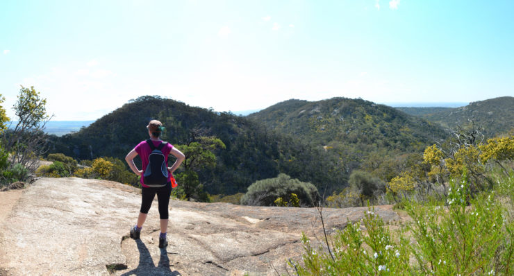
There are several walking options at You Yangs Regional Park, but there’s no doubt that this is the highlight of the park. It can even be divided into two separate walks if you’re looking for something shorter.
Starting with the East West Walk, you’ll circumnavigate Flinders Peak, taking in stunning views across the park, huge granite boulders everywhere, and an array of wildflowers in the warmer months. Finish your walk with the short (return) climb to Flinders Peak, named after explorer Matthew Flinders who summited in May 1802 to survey the area. At 319 metres, the peak makes for excellent views across the western volcanic plains to the city and Port Phillip Bay.
Where: Turn off the Princess Freeway at the Little River exit and head north towards Little River. From Little River, follow the signs to You Yangs Road and then to the You Yangs Regional Park. This hike leaves from Turntable Carpark.
Length: 7.5 km.
Difficulty: Moderate.
Best Time: Year-round.
Inspiration Outdoors run a day tour to Yo Yangs Regional Park. Click here for details.
-
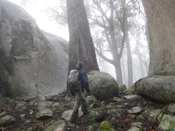
Four Brothers Rocks, Bunyip State Park
(featured article image)
The highlight of this hike is the view from Four Brothers Rocks, so if that’s why you’re visiting it may not be worthwhile in Winter when cloud commonly shrouds the area. You won’t see a thing. Having said that, the rocks themselves are amazing and can be nice to explore in the thick fog.
Part of the circuit walk takes in the Mortimer Nature Trail, dense with interesting vegetation and many interpretive signs that explain it. This is followed by some steep climbing – which is great training for longer, more difficult hikes – up towards the beautiful Four Brothers Rocks.
Where: From Gembrook, head east on Beenak East Road and then continue along Gembrook-Tonimbuk Road. Keep an eye out on the left for the signed Mortimer Picnic Ground.
Length: 14 km.
Difficulty: Moderate.
Best Time: Best visited in the warmer months for excellent wildflower displays. The walking trails will also be much less slippery and you’re more likely to be able to enjoy the views.
-
Werribee Gorge Circuit, Werribee Gorge State Park
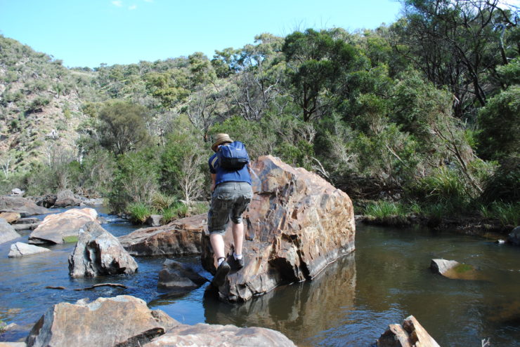
This one is a little more adventurous with lots of rock scrambling and a couple of river crossings. Werribee Gorge itself is stunning, carved by the Werribee River over millions of years. Scrambling alongside the river here, it’s hard to believe that you’re only an hour from the city.
There are some stunning views from lookouts on the eastern section of this circuit, but the best part for me is traversing the gorge along narrow rock ledges, sometimes assisted by cables attached to the rocks, and scrambling over flood debris.
Where: From Bacchus Marsh, follow the signs to Geelong and then turn right at the roundabout just before the railway line (onto Griffith Street). Turn right into McCormack Road after approximately 2 km and after a further 2 km, turn right into Ballan-Ingliston Road (aka Ironbark Road). The trailhead is in a small carpark, a few hundred metres after you cross a railway line.
Length: 13 km.
Difficulty: Moderate – Difficult
Best Time: This walk is great all year round, but not advisable after heavy rains.
Inspiration Outdoors run a day tour to Werribee Gorge. Click here for details.
-
Lerderderg Gorge Northern Circuit, Lerderderg State Park
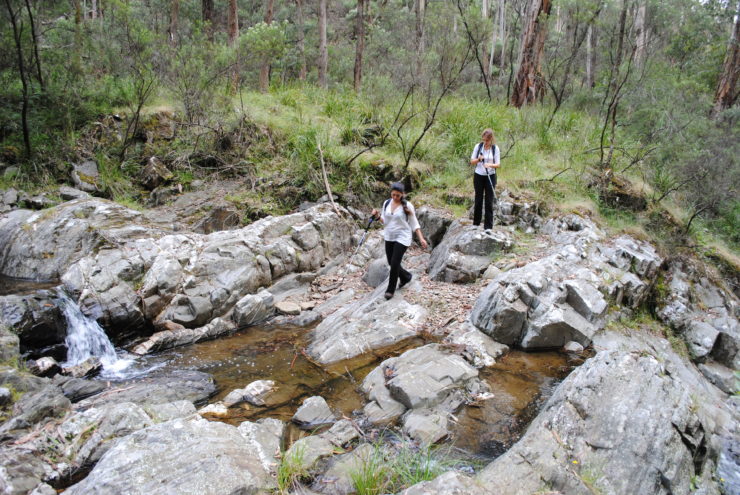
Another of Melbourne’s spectacular western gorges, Lerderderg is even more rugged and beautiful than Werribee Gorge. There’s nothing like rock-hopping your way alongside the gently flowing Lerderderg River, surrounded by near vertical sandstone walls as high as 300 metres in places.
There are loads of hiking options in Lerderderg Gorge but the best I’ve found is a mostly off track circuit in the northern part of the park. It starts with about 5 kilometres of easy walking on a vehicle track called Lerderderg Track, where a narrow and indistinct trail descends a spur to the river. From here there are no trails. You’ll need to find your own way from here, rock-hopping along the riverbanks (and occasionally crossing the river), and turn north into Watties Creek and continue doing the same.
It’s tough going and you’ll need to leave early and allow an entire day, but it’s well worth the effort.
Where: Exit the Calder Highway at Gisborne and follow the signs toward Bacchus Marsh. Turn right after about 12 km into Carrolls Lane. Veer left at the next intersection and then turn left onto O’Briens Road. After about 4 km you’ll find the junction with Lerderderg Track, where you’ll begin the walk.
Length: 14 km.
Difficulty: Difficult.
Best Time: This walk is great all year round, but not advisable after heavy rains or when the river is running high.
-
Cathedral Range, South Circuit
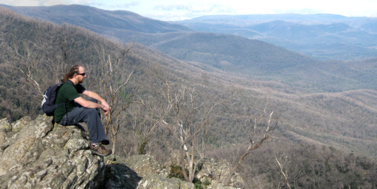
Cathedral Range is absolutely my favourite place in Victoria, if not the world.
Surrounded by rural plains, a striking mountain range of exposed rocky peaks and ridges juts out from the landscape. The entire range can be traversed in two days, but it can easily be split into two separate day hikes, the best of which is the southern circuit.
Ascending the wooded slope directly opposite the Sugarloaf Saddle carpark, you’ll soon find yourself climbing exposed rock slabs toward Sugarloaf Peak. Don’t attempt this if you don’t have a head for heights, as at times it’s almost like rock climbing without the ropes.
The views from the summit are incredible and they continue as you make your way north along The Razorback, a ridge of upturned sandstone, where you’ll scramble over, around, and even under some massive sandstone boulders.
The ridge hike ends at The Farmyard, the park’s only walk-in campground, which is named for its Lyrebirds who’ve been known to mimic the sheep and cow sounds from the surrounding farmland.
From here you can take an optional side trip to South Jawbone Peak for another short but tough climb and more breathtaking views. When you’re ready, descend the range to Jawbone Carpark and trudge back up Cerberus Road again to your vehicle. The final few kilometres of the hike are hard work considering they’re along a dirt road and mostly uphill, but they’re well worth the effort if you don’t have another vehicle to leave at Jawbone Carpark.
Where: Turn right off the Maroondah Highway into Cathedral Lane, just after the township of Buxton. Follow the signs from here to Sugarloaf Saddle.
Length: 9 km.
Difficulty: Moderate – Difficult.
Best Time: Year-round. Shouldn’t be attempted straight after rain as the climb to Sugarloaf Peak will be treacherous with slippery rocks.
-Neil Fahey
Guest Blogger


